Put the history in place.
Relate old grids, drill records and geological observations to the supplied footprint and verified rights.

Decades of exploration. A landscape of geological questions. Bringing the evidence together for a fresh focus on bedrock gold.
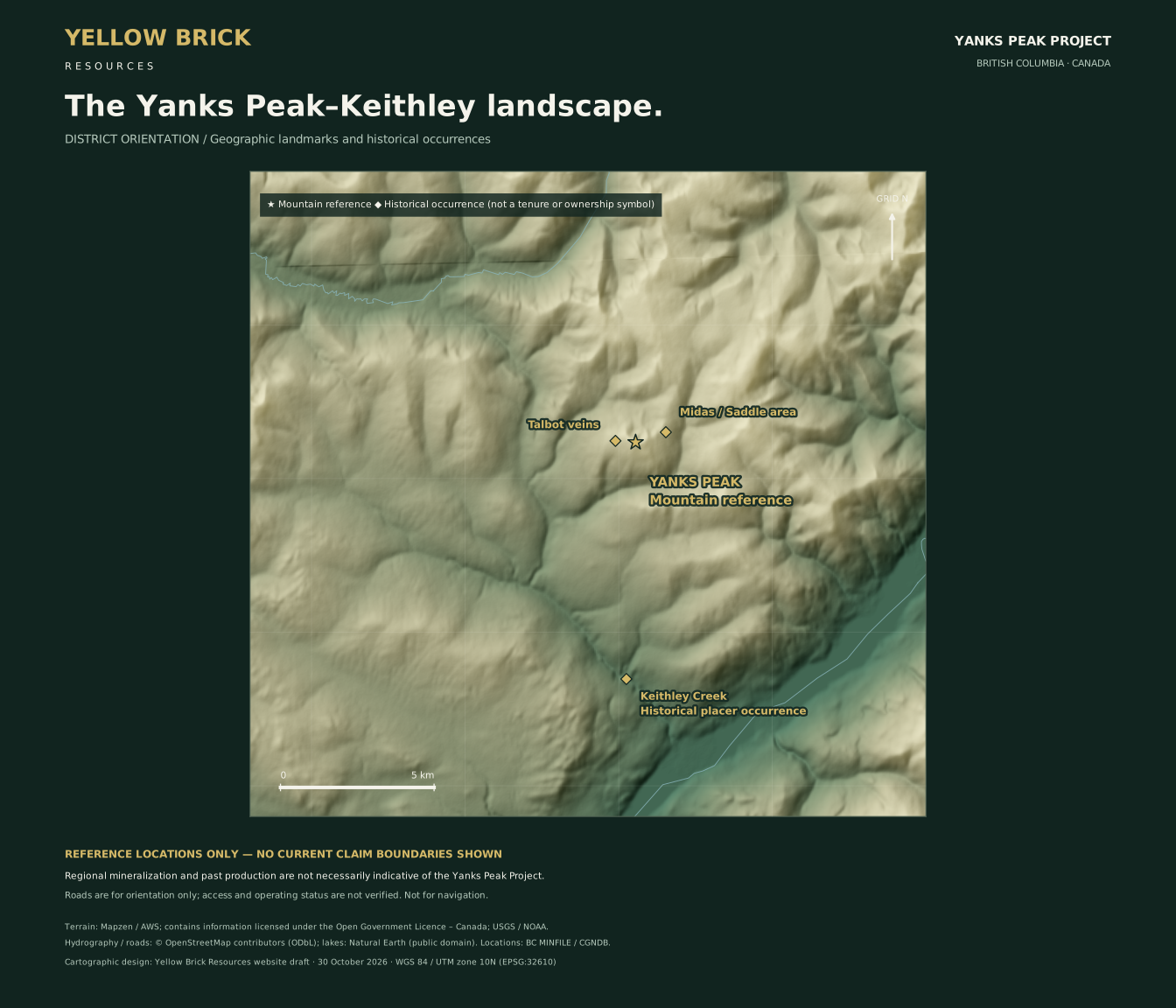
Past drilling and ground surveys give us a starting point—not a finished geological model. The opportunity is to reconnect the records, understand what earlier work tested, and sharpen the questions that remain.
Approximate drilling subtotal and method-specific survey totals across the wider historical property—not an audited lifetime inventory or work confirmed entirely within the supplied current mineral outline. These are not mineral resources or reserves. Sources and limitations →
Magnetics, chargeability and resistivity offer different views of the subsurface. Together with geology, they can help identify the structures and contacts that deserve a closer look.
A geophysical response is not a gold assay. The historical interpretation remains a hypothesis to be tested.
Understand the exploration thesis →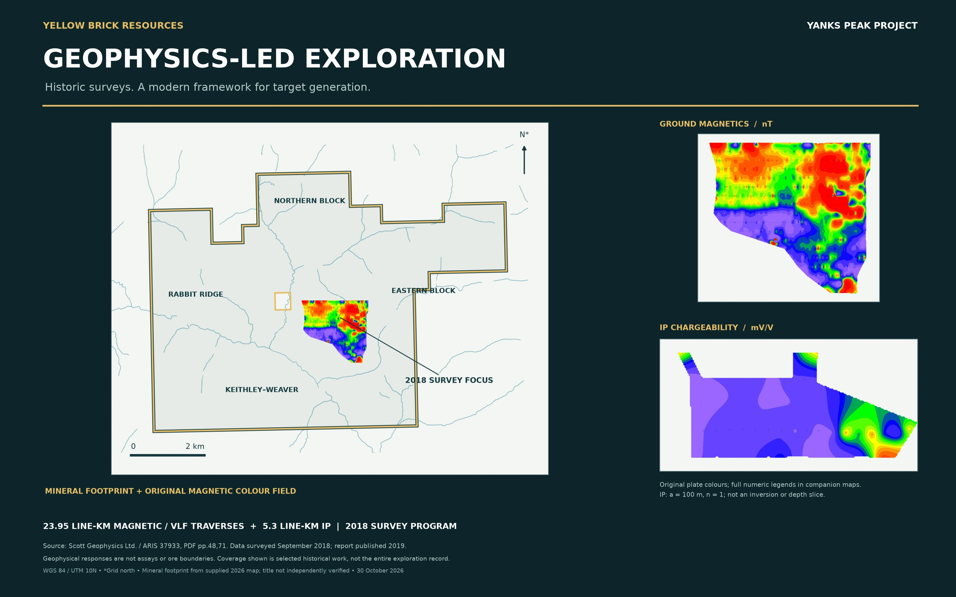
The proposed direction is straightforward: establish the ground position, build a consistent geological picture, and advance through verification.
Relate old grids, drill records and geological observations to the supplied footprint and verified rights.
Compare structures, rock contrasts and complementary survey responses. Test alternative explanations.
Use documented field observations and reproducible sampling to determine which targets merit advancement.
A proposed exploration direction, not an approved, funded or permitted field program. Work depends on technical review, funding, access, applicable authorizations and appropriate engagement.