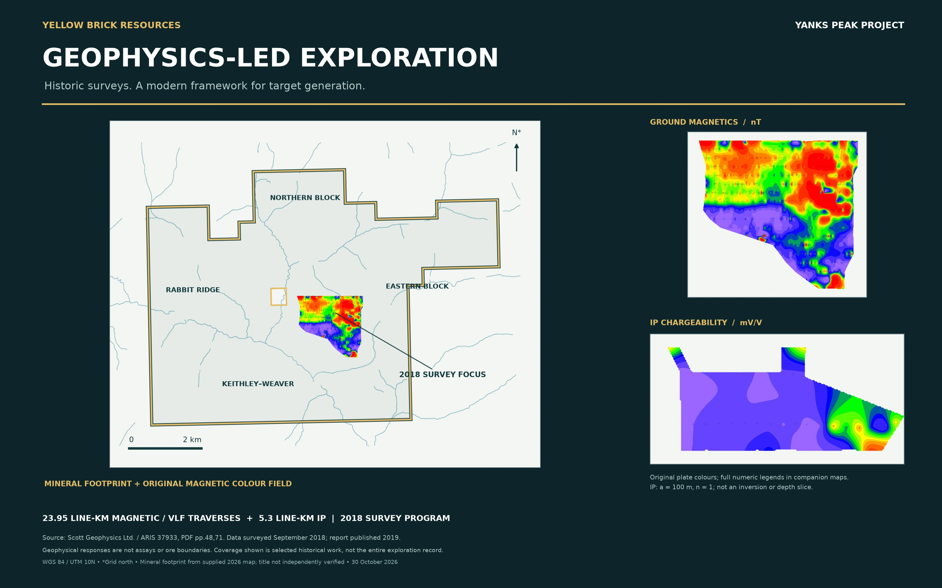
 01 / Survey context
Integrated geophysics
Original magnetic imagery registered to the supplied outline. Complete numeric legends are in companion maps.

Six source maps. Original legends. The geographic and geophysical record, open for inspection.
Revision-3 geophysics retains original report colours and coverage limits. The supplied 2026 outline does not independently verify registered interests. Anomalies are not gold assays, ore boundaries or resources. Terrain maps provide geographic context only.
01 / Survey contextOriginal magnetic imagery registered to the supplied outline. Complete numeric legends are in companion maps.
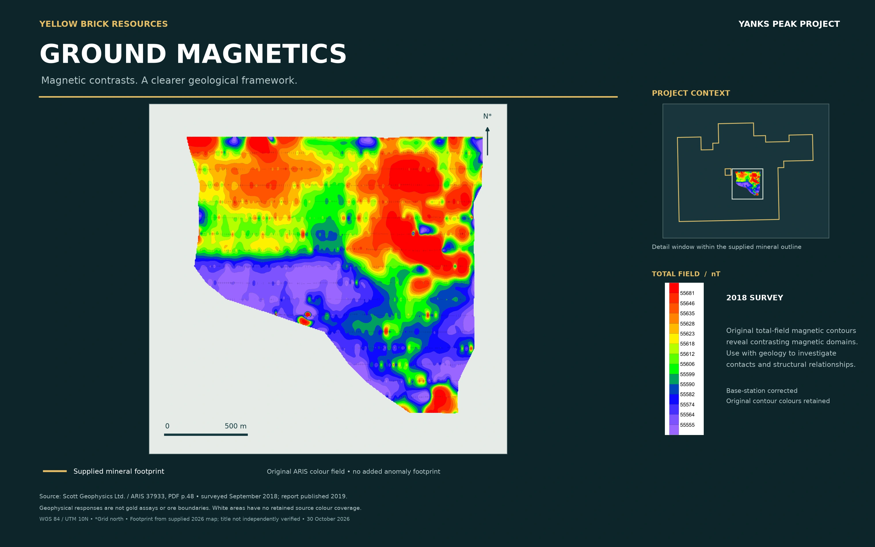 02 / Total field · nT
Original 2018 total-field magnetic imagery, numeric legend and context inset. Magnetic highs are not gold assays.
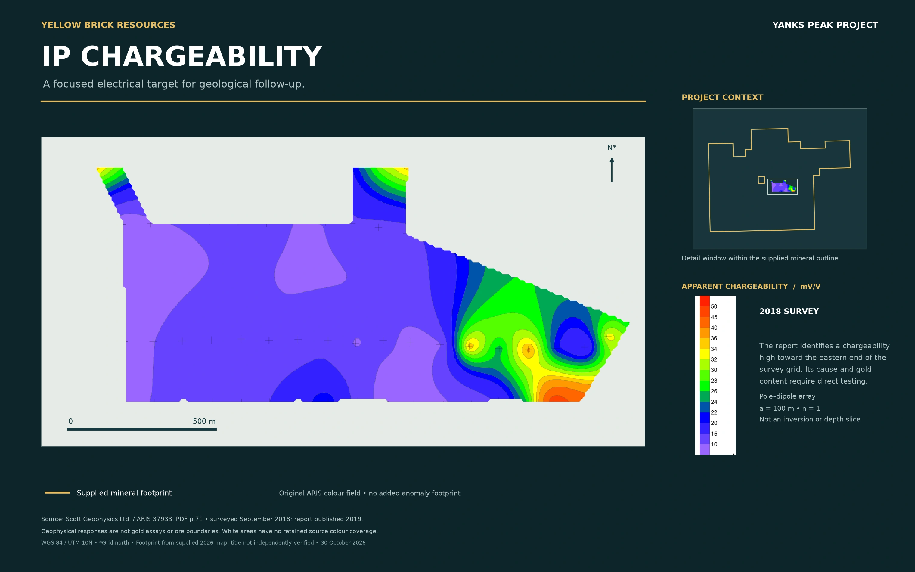 03 / Apparent chargeability · mV/V
Pole–dipole first separation, a = 100 m, n = 1. Not a depth slice or inversion model.
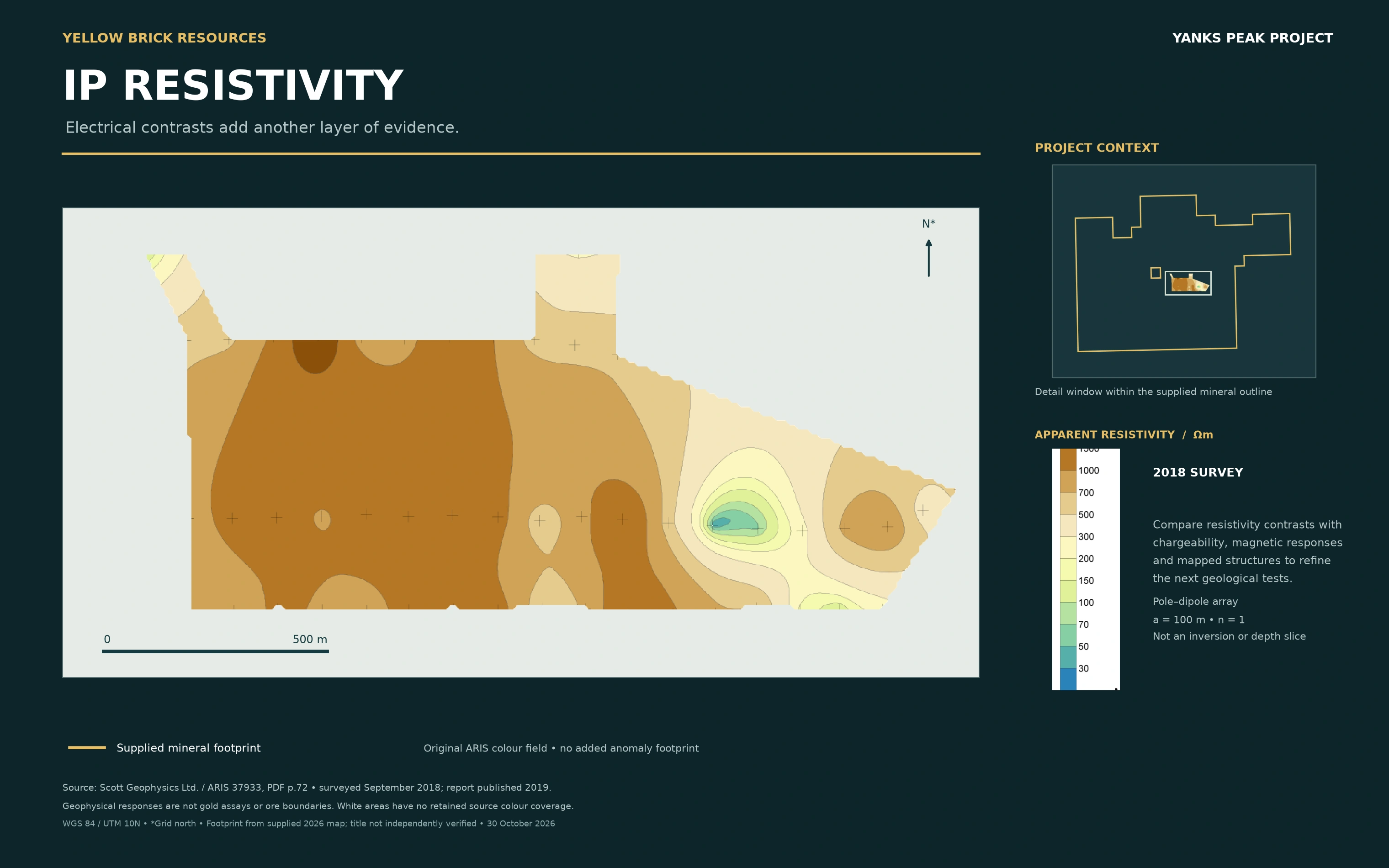 04 / Apparent resistivity · Ωm
Original apparent-resistivity plan and numeric legend. Direct testing remains necessary.
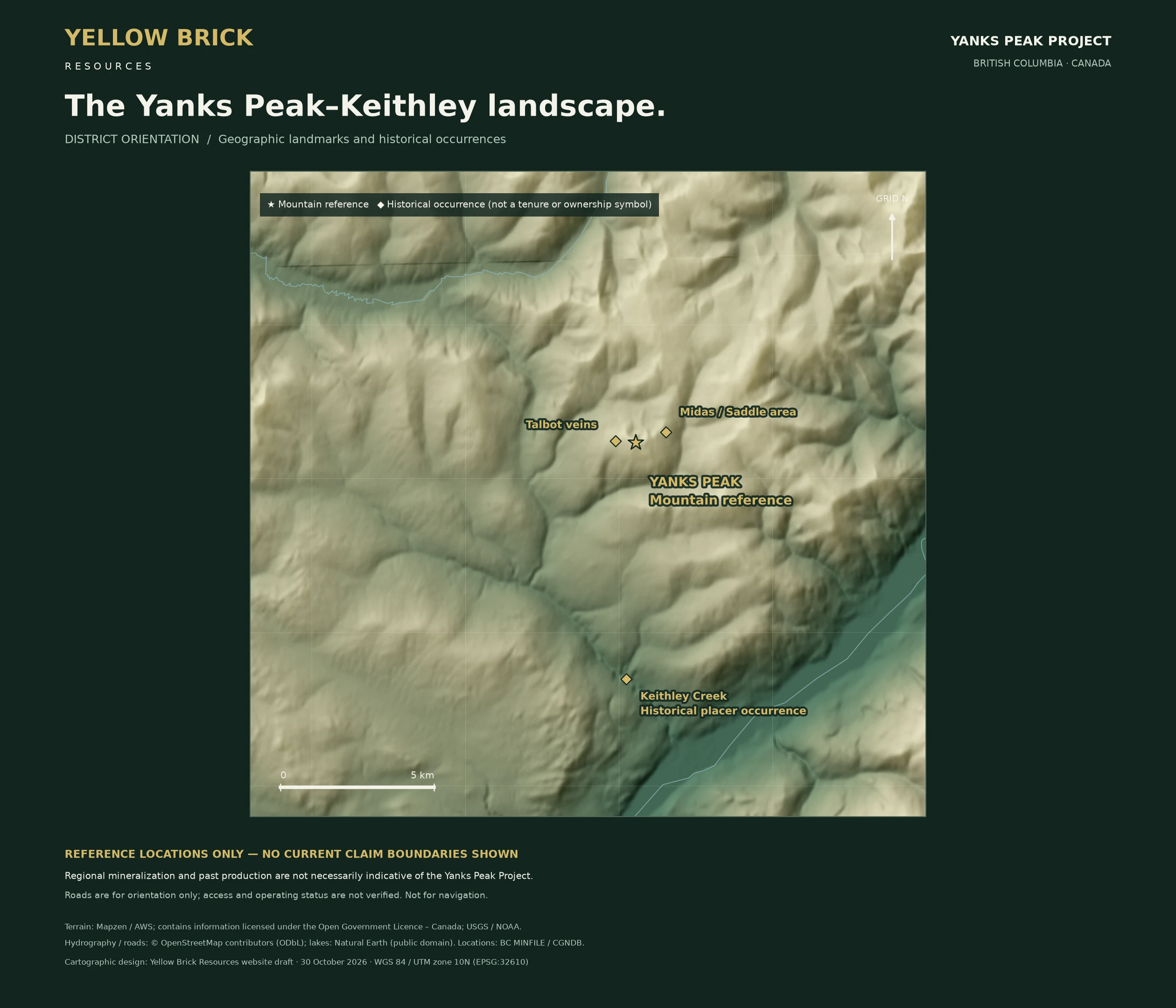
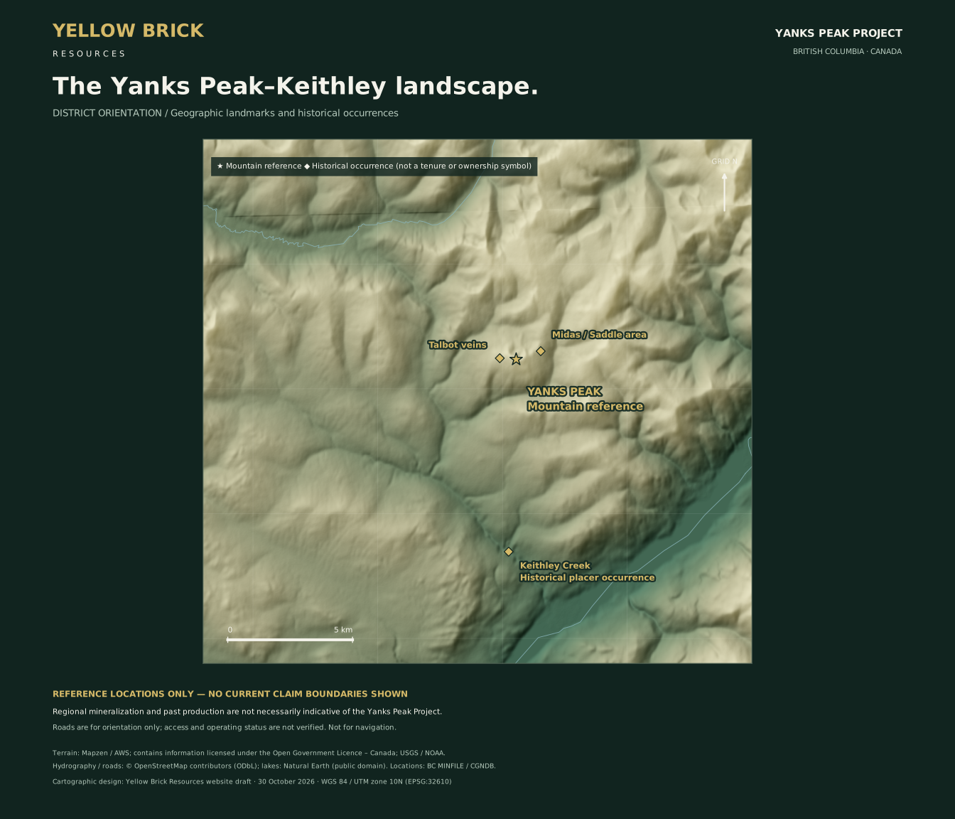 05 / Yanks Peak–Keithley landscape
Shaded terrain and historical reference points. No current claim boundaries are shown on this older context map. Not for navigation.
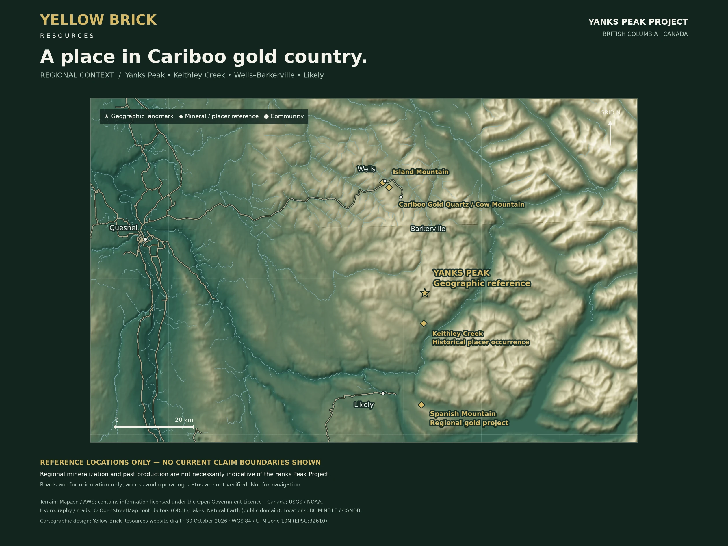
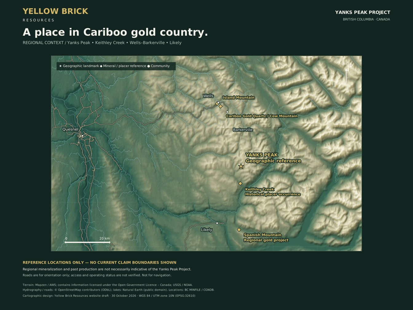 06 / Cariboo gold country
Regional landscape and separate historical gold references. Nearby mineralization is not necessarily indicative of Yanks Peak. Not a tenure map.
Geophysics: Scott Geophysics Ltd. / ARIS 37933, September 2018 fieldwork, report published 2019. Physical PDF p.48: magnetics; p.71: chargeability; p.72: resistivity. New branding does not change original authorship.
The IP plans interpolate four survey lines. Coloured area is not a mineralized footprint; white or transparent areas do not mean measured zero. No numerical regridding, extrapolation, inversion or generated geophysical imagery was performed in the supplied revision-3 maps.
Mineral outline and local drainage: supplied 2026 GeoPDF and its identified Canadian base-map source. Outline recovery is not legal-title verification. Drainage is generalized orientation linework.
Terrain: Mapzen / AWS Terrain Tiles. Contains information licensed under the Open Government Licence – Canada; source acknowledgments include USGS and NOAA. Terrain source attribution.
Roads and waterways: © OpenStreetMap contributors, Open Database Licence. Lakes: Natural Earth, public domain. Historical references: BC MINFILE. Mountain reference: Canadian Geographical Names Database.
WGS 84 / UTM zone 10N (EPSG:32610). Terrain is shaded elevation data, not aerial photography or geological mapping. Roads, access, operating status and permissions are not verified. Keep complete legends and source context with reused maps.